GIS for site design ∙ Natalie Yates ∙ SP16


REGIONAL FLOW NETWORKS
St Louis as a whole, was chosen as the focus for the GIS class. Mapping exercises were conducted in order to understand on a deeper level the systems at play in the region. Analysis was conducted on St Louis’s hydrography utilizing flow accumulation tools, and slope analysis. Vacancies were parsed out, and building footprints datasets were refined down to flood risks.
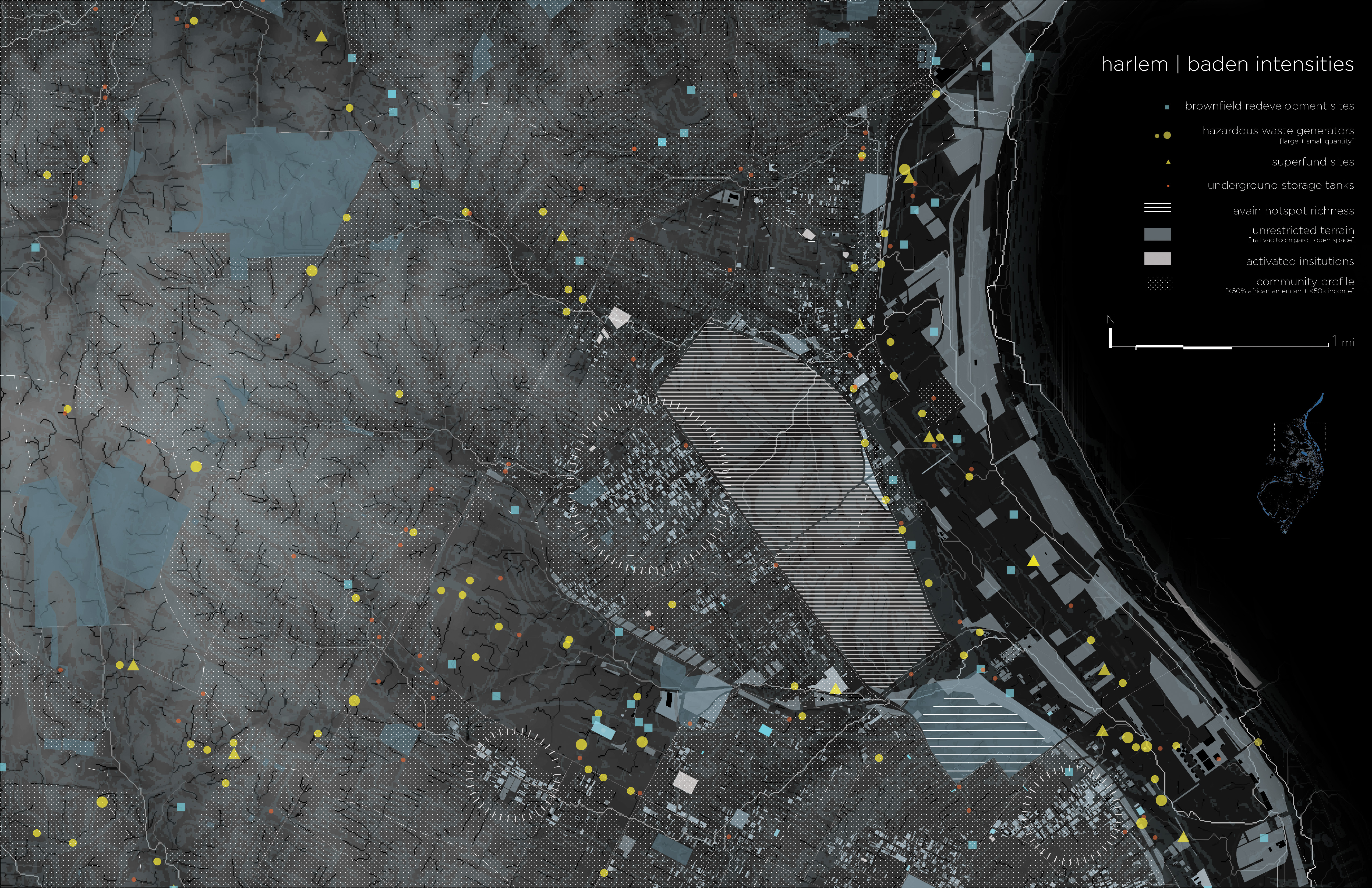
PROSPECTIVE LANDSCAPES
Subsequent mapping exercises, supplemental to studio focus, were on areas of intensities. These circled areas of intensities are terrains deemed prime for landscape intervention. They have a high flood-risk and a significant amount of under-utilized spaces. They are in some cases surrounded by, include, or are in close proximity to, anchor institutions and near avian hotspots. The community profile is a subset of general race and income demographic data. The subset of people represented in the census tracts have a majority African American population and a mean house-hold income of less than $50,000. The divide is clearly shown from map to map, moving South through St. Louis.
These circled areas could serve as terrains for future resiliency design investigations.
St Louis as a whole, was chosen as the focus for the GIS class. Mapping exercises were conducted in order to understand on a deeper level the systems at play in the region. Analysis was conducted on St Louis’s hydrography utilizing flow accumulation tools, and slope analysis. Vacancies were parsed out, and building footprints datasets were refined down to flood risks.
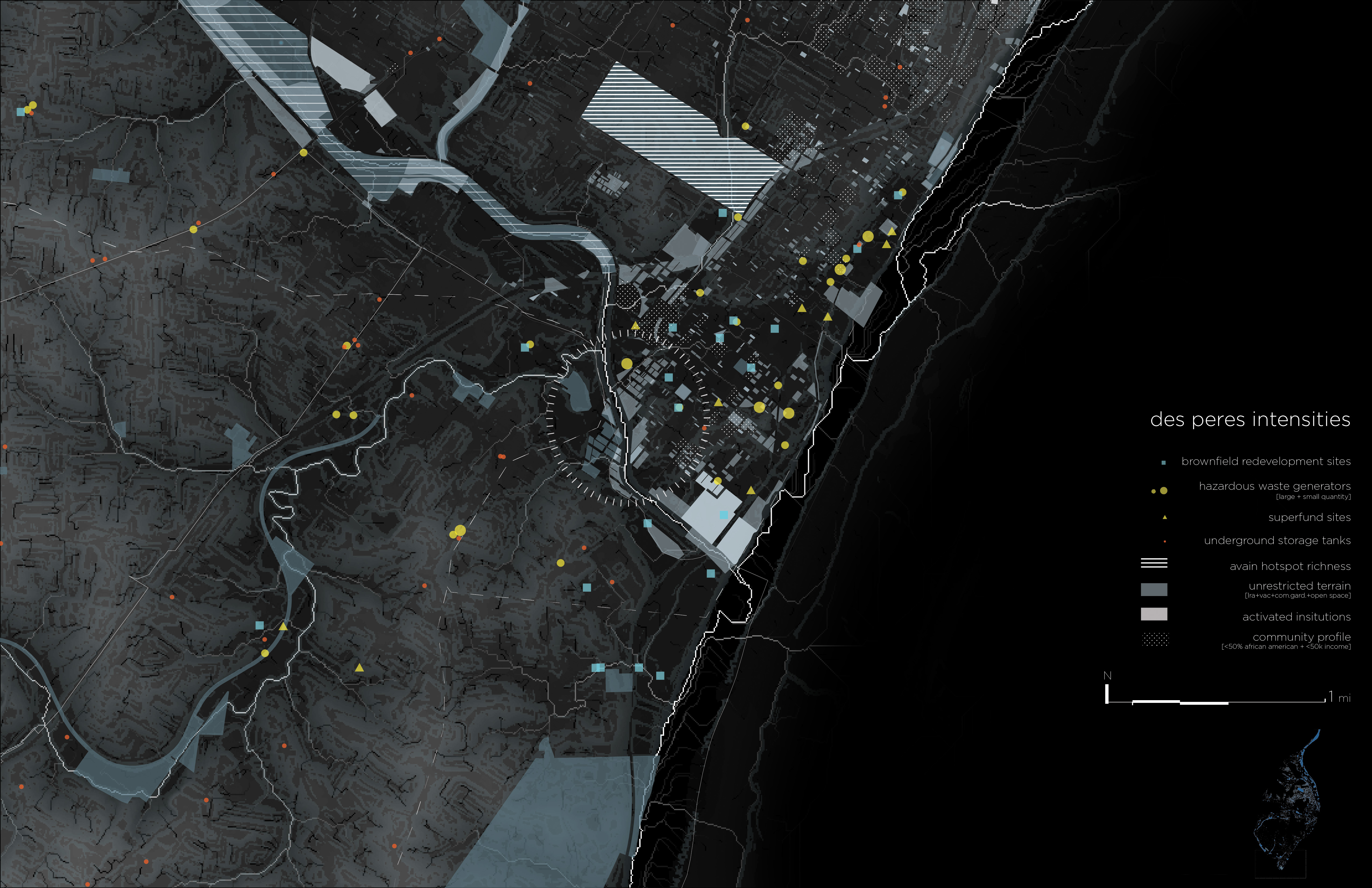
PROSPECTIVE LANDSCAPES
Subsequent mapping exercises, supplemental to studio focus, were on areas of intensities. These circled areas of intensities are terrains deemed prime for landscape intervention. They have a high flood-risk and a significant amount of under-utilized spaces. They are in some cases surrounded by, include, or are in close proximity to, anchor institutions and near avian hotspots. The community profile is a subset of general race and income demographic data. The subset of people represented in the census tracts have a majority African American population and a mean house-hold income of less than $50,000. The divide is clearly shown from map to map, moving South through St. Louis.
These circled areas could serve as terrains for future resiliency design investigations.